Terrain · Relief · Landscape
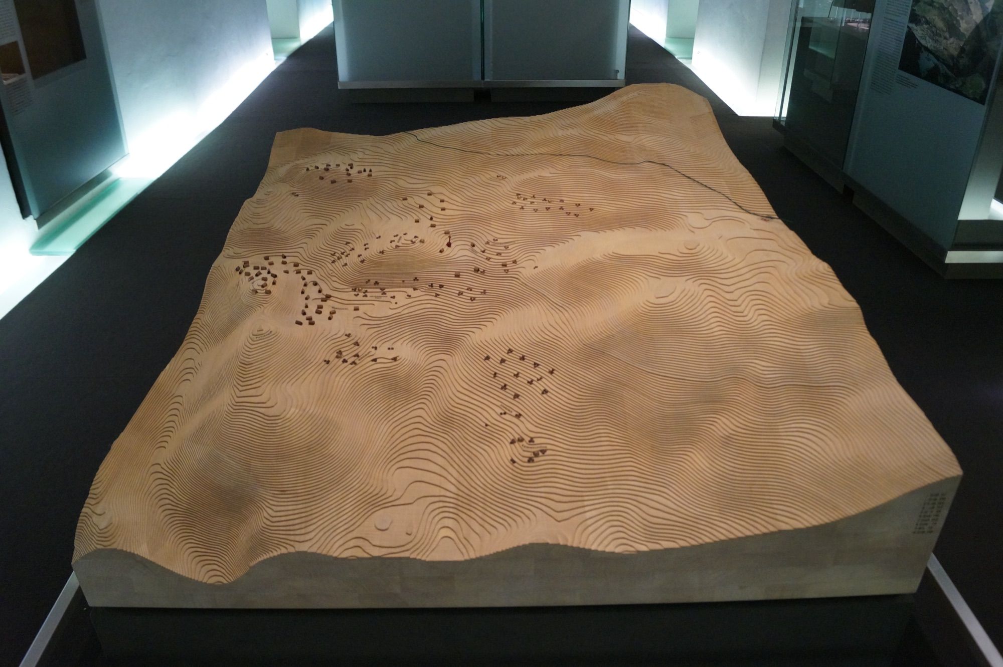
Topographic models of terrain, relief and landscape, built from your survey data
We build topographic models from your contours, survey or LiDAR data, as stepped contour layers, smooth CNC-milled relief or 3D printed terrain, all hand-finished in our Madrid workshop.
- Scales from 1:5000 to 1:100
- From DWG, DTM, LiDAR or survey data
- Typically €600–€4,000 (excl. VAT)
- Replies within 1–2 working days
01What it is
A physical model of the ground your project stands on
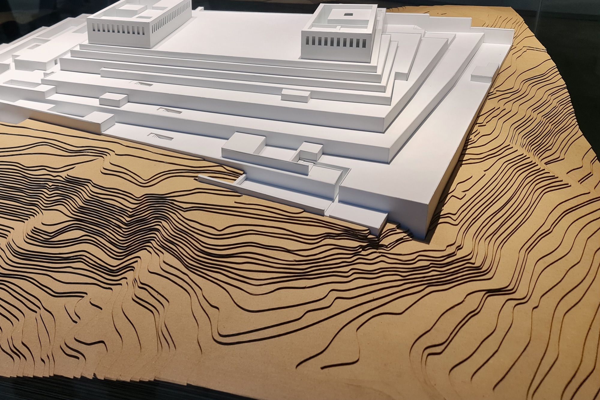
A topographic model is a physical scale model of a piece of land: its levels, slopes, valleys and watercourses in three dimensions. On its own it explains a landscape or a territory. As a base, it shows how a building or a whole scheme sits on its site, and slopes that are hard to read on a contour plan become obvious once people can walk round the table.
We make bespoke scale models for architects, developers and industry, and physical terrain models are the most data-driven of them. Their accuracy depends on how well the survey is prepared before anything is cut, so that is where we start.
- Architects and landscape architects — site, context and competition bases
- Developers and masterplanners — whole schemes in their landscape
- Engineering, quarrying and energy — mineral sites, wind and solar farms
- Visitor centres and museums — relief for display and teaching
02Methods compared
Three ways to build topographic models
The method changes how the terrain reads, how long it takes and what it costs.
03Data preparation
Topographic model makers who handle the data for you
The hard part is rarely the making; it is turning a topographic map, a survey or a LiDAR tile into files a laser cutter or CNC router can use. You don't have to do that yourself. We clean and crop the terrain, set the contour interval for the scale and decide whether to exaggerate the vertical scale so that gentle slopes still read.
Because the laser cutters, CNC router and 3D printers share one workshop, we choose the method for each element rather than for the whole job: milled terrain, printed buildings, laser-cut roads and planting placed by hand.
- Inputs: DWG/DXF contours, survey, LiDAR, DTM/DEM in GeoTIFF
- No data yet? We can start from public mapping and elevation data, in the UK or elsewhere
- Abstract (white, timber) or realistic (planting, water, roads) finishes
04Applications
Site, landscape and visitor centre models
05Process
From survey to finished model
- 01
Send the site and the data
The site boundary, the scale you have in mind and whatever data you hold. We reply within 1–2 working days.
- 02
Prepare the terrain
We turn your data into a clean digital terrain at the right contour interval, then add buildings, roads and water. You sign off a preview before anything is cut.
- 03
Cut, mill or print
Laser, CNC or 3D printing. Large sites are split into modules with discreet joints.
- 04
Finish by hand
Paint, scale planting, water and labels, plus LED lighting if needed, on a base with a title plate and an optional acrylic case.
- 05
Pack and deliver
Delivery and installation in Madrid and the surrounding area, and shipping across Spain in purpose-built packaging. The UK, the rest of Europe and beyond on request.
06Specifications
Scales, source data and lead times
| Scale | What it shows | Usual method |
|---|---|---|
| 1:5000 – 1:1000 | Territory, golf courses, quarries; at 1:1000, 1 mm is 1 metre | Milled relief or 3D printing |
| 1:500 | Masterplans, urban context, competitions | Stepped contour layers |
| 1:200 | A site with its building and surroundings | Contour layers or milled relief |
| 1:100 | Detailed landscape, gardens and courtyards | Contour layers, hand-finished |
Materials
- MDF and birch plywood
- Grey board and cork for contour layers
- Lime wood for milled relief
- Resin (SLA) and PLA/PETG (FDM)
- Acrylic for water and display cases
Finishes
- Matt white or natural timber
- Colour by level or land use
- Scale planting, figures and vehicles
- LED lighting and a base with title plate
Data we work from
- Contours in DWG/DXF
- Topographic survey
- LiDAR, DTM or DEM (GeoTIFF)
- Revit, Rhino, SketchUp, STL
Lead times
- Reply to your enquiry: 1–2 working days
- Competition contour base: from 3–5 working days
- Finished presentation model: 2–4 weeks
- Large format: 4–10 weeks
08FAQ
Questions about terrain, data and scale
It is a physical scale model of a piece of land, showing levels, slopes and watercourses in three dimensions. Topographic models can stand alone to explain a landscape or form the base for a building or masterplan, and are built from stepped contour layers, milled relief or 3D printing. You may also see them called topographical models; it is the same thing.
Choose stepped contours when people need to read levels. Each layer is one contour interval, so a 2 m interval at 1:500 becomes a 4 mm layer, and it is also the quickest method to build. Choose smooth CNC-milled relief when the model should look like the real landscape, for display or tactile use. For rugged terrain at small scales, 3D printing often gives the most detail.
Yes, and you don't need to convert anything yourself. Send contours as DWG or DXF, a topographic survey, a LiDAR point cloud or a DTM/DEM as GeoTIFF, and we turn it into cutting or milling files. If you only have a site boundary, we can work from public elevation data and tell you up front whether its accuracy is enough.
A physical one is usually called a relief map, a raised relief map or a topographic model; architects often say site model or contour model. The digital version is a digital terrain model (DTM) or digital elevation model (DEM), which is the data we build from. We make the physical object, from a desk-sized relief to a visitor centre centrepiece.
Work back from the size of the site and the table the model has to fit on. At 1:1000, 1 mm on the model is 1 metre on the ground, which suits golf courses, quarries and wider territory (down to 1:5000 for very large areas). Masterplans and competitions usually sit at 1:500, a site with its building at 1:200 and detailed landscape at 1:100. At small scales we often exaggerate the vertical so gentle slopes still read. Tell us the maximum footprint and we'll propose a scale.
As a guide, a topographic or landscape model costs €600–€4,000 (excl. VAT), depending on its size, scale, method and finish, plus packing and delivery. Our model price guide sets out every model type, explains what drives the price and has a form to request a tailored quote.
A white contour base for a competition can be ready from 3–5 working days, a finished presentation model in 2–4 weeks and a large-format piece in 4–10 weeks. Large sites are split into modules with discreet joints that fit together on arrival. We deliver and install in Madrid and ship across Spain, with wooden crates for large pieces; the UK, the rest of Europe and on-site installation elsewhere are quoted on request.
Send us your survey data and we'll suggest a method
Share the site, the scale and whatever data you have, and we'll reply within 1–2 working days with a method, a lead time and a quote.
09Other services